IN THIS ARTICLE
As summer ends and the fall foliage begins to flourish, there is no better way to see the beautiful views your region offers than on a scenic road trip close to home. No matter the direction you choose to go, pack your phone charger and take one of these suggested routes to ensure incredible views along the way. These are some of the most beautiful scenic drives in our country and they will quench your desire to escape city life and get into nature.
Best App For Scenic Routes
Don't miss these awesome apps to help you piece together one of the best scenic drives in your area. Enter your starting point and destination to let these apps highlight all of the important stops in between. Whether looking for hikes, wineries, parks, historical sites, gas stations, views, state parks, hotels, restaurants, or other points of interest, these apps will make sure you do not miss a thing!
- Waze - Waze is an awesome app for real-time directions and road updates. The app uses reports from other drivers to offer you the fastest, most efficient route at the time you are driving. This is especially helpful when driving through busy cities during peak times. Don't spend your road trip in terrible traffic. Let Waze plan your route and distance in real-time!
- GasBuddy - Although Waze is beginning to track gas pricing, GasBuddy works to find you the cheapest gas along your route. Like Waze, GasBuddy takes reports from other users to keep their information current.
- Roadtrippers - This app is an awesome planning tool. Enter your starting and ending location into the app and Roadtrippers will fill everything in between. From your driving distance, best route, points of interest, and even hotels and restaurants, Roadtrippers has you covered.
Great Scenic Drives Near DC
Blue Ridge Parkway

Start here: Rockfish Gap, VA
End here: Asheville, NC
Total miles: 469 miles
How many days: 2-3 days
Get the route here.
For a taste of Appalachia and one of the most popular scenic drives, travel the famed Blueridge Parkway route that stretches from Rockfish Gap, Virginia past the up-and-coming town of Asheville, North Carolina. This route is a must-see in the fall for beautiful views when the seasonal foliage lines the one-lane state route that takes you through this journey. Your scenic drive will take you along the spine of the Blue Ridge Mountains and up the crest of Virginia’s highest elevation, Apple Orchard Mountain.
As you enter North Carolina you will travel through the trees of the Pisgah National Forest. Stop for a hike or continue on the scenic byway for more epic views. You will then traverse Grandfather Mountain, which is the highest point of the Blue Ridge Mountains, and adjacent to the not-to-be-missed resort of Blowing Rock. Continue then across the Black Mountains and Great Craggy Mountains for more scenic views.
As you near the French Broad River you will be close to the town of Asheville, North Carolina. This is a seriously up-and-coming part of Appalachia drawing transplants from various parts of the US. Stay here to enjoy fine dining, nightlife, and entertainment close to the end of your journey. If you wish, after Asheville, you can continue on the Parkway where it reaches its highest elevation (over 6,000 feet) just before the Appalachian Mountains and Cherokee Indian Reservation. Appalachia is a real treat and scenic trails like the Blue Ridge Parkway are not to be missed.
Highland County Way Route

Start here: Washington, DC
End here: Highland, VA
Total miles: 202 miles
How many days: 2-3 days
Get the route here.
This scenic byway lets you leave big city life behind you and head down winding countryside to the romantic Highland County in Virginia. This weekend adventure lets you enjoy the spectacular view of the fall foliage of Shenandoah as you head towards the scenic "Switzerland of Virginia" in Highland County.
Starting in Washington D.C, head southwest on this scenic byway towards Charlottesville, VA. Stop by UVA for a delicious farm-to-table lunch at Farm Bell Kitchen. After lunch, continue on into incredible scenery brought to you by Shenandoah National Park and the George Washington and Jefferson National Forests. Stop for some hiking or other outdoor adventures or continue on to enjoy the countryside of grazing cows and sheep as you enter Highland County. Romantic lodging is abundant but a stay at the Laurel Inn Retreat will not disappoint.
DC Monument Tour

Start here: Lincoln Memorial (Washington DC)
End here: US Capitol Building (Washington DC)
Total miles: 2 miles
How many days: 1 evening
Get the route here.
Although this may not be your first thought when you hear "scenic drives near me," this tour of our nation's historic sites and overall history makes this scenic drive one that will fill your cup with inspiration. This route is ideal day or night, but shining lights under the night sky make these views especially memorable.
Start this trip through DC with a visit to the Lincoln Memorial, but consider parking to enjoy views of the Mall from this location. There is a parking lot close by if you want to stretch your legs for a bit. If walking, hike around the Korean War Veterans Memorial, Martin Luther King Jr. Memorial, and Vietnam Veterans Memorial. This route covers a short distance, but hop back in your car to continue on this road trip through DC.
After driving past the Lincoln Memorial, pass the Washington Monument and Jefferson Memorial before coming to the end of the Mall and the US Capitol Building. Loop around the mall to drive past the White House before ending your night with a craft cocktail from the Columbia Room. Although covering a short distance, this historical route is filled with sights to see.
SHOP SOZY


Scenic Drives Near L.A.
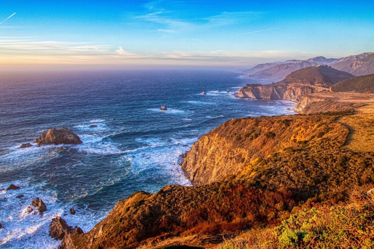
Pacific Coast Highway (PCH)
Start here: Santa Barbara, CA
End here: Monterey, CA
Total miles: 237 miles
How many days: 4-7
Get the route here.
This portion of California’s coast is beautiful and definitely qualifies as a "bucket list" drive. The area between the glitz and glamour of Hollywood and the tech-driven Silicon Valley offers some of California’s best coastal views. Not only is it one of the prettiest roads to drive, but it is littered with cultured and funky stops along the way. Start off at the American Riviera in Santa Barbara and head north on Highway 101. If you are into wine culture, pull off in Buellton (about 40 minutes north) and head east on the byway to the various wineries littering the Santa Ynez Valley. Don’t miss the charm of Los Alamos, which, in recent years, has become a hipster foodie destination.
Continue north on the 101 through Santa Maria and you eventually reach San Luis Obispo. Here, you merge onto the famed state route Highway 1. Travel through touristy beach towns like Morro Bay, funky enclaves like Cayucos, and more elegant sleepy towns like Cambria.
Cambria is a great place to stop for the night. Here are a few tips to make your stay perfect. Take a hike through the Fiscalini Preserve or along the Moonlight Beach Boardwalk. Enjoy one of the town's famed wineries, like Moonstone Cellars, and stay at one of the various hotel choices along Moonstone Beach. You cannot go wrong at El Colibri. Enjoy dinner at Robin's or Sea Chest and fall asleep to the sounds of the waves crashing outside your hotel room.
In the morning, you can tour a piece of history at Hearst Castle and take a short hike to see a swath of Elephant Seals in San Simeon. Next, you’re on to Big Sur as you pass through Ragged Point. Big Sur is home to various state parks with loads of hiking, idyllic campgrounds, and high-end glamping locations featuring decked-out yurts and cuisine from world-famous chefs. End your journey with a cruise through 17-Mile Drive in Monterey, the home of Pebble Beach and other world-class golf courses. This road trip is one you will never forget.
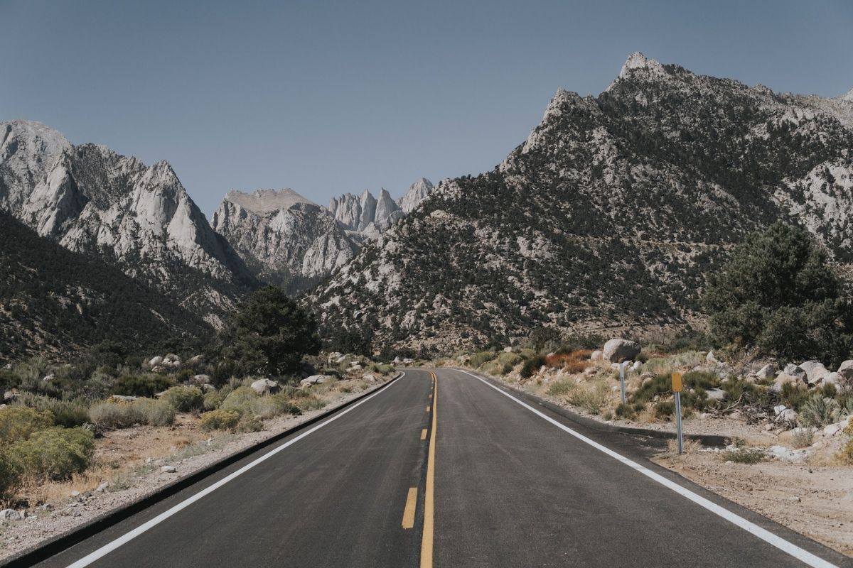
Highway 395 Route
Start here: Los Angeles, CA
End here: Convict Lake, CA
Total miles: 369 miles
How many days: 3 days
Get the route here.
A summer or fall tour through the Eastern Sierras, is one of the best scenic road trips in California. Travel northwest from Los Angeles to reach the junction of Highway 395 and 58. Proceed north on Highway 395 until you reach the country town of Lone Pine. From here you can drive west up Whitney Portal Road for a view of California's highest peak - Mt. Whitney. Settle in for the night if you like, or continue north to Bishop. As you proceed further, you can’t miss experiencing the hot springs, either at Keough's Hot Springs or Wild Willy's.
Your next stop will be at or near Mammoth Lakes. While it is a booming ski town in the winter, it offers a unique summer experience as well as attractions and adventures for mountain bikers and hikers alike. Nearby attractions include Devil's Postpile National Monument and Convict Lake. A cozy cabin at June Lake and dinner at the Eagle’s Landing Restaurant is another option to unwind along this journey.
From here, you can either journey east on Highway 120 to Yosemite, or continue north on 395 until you reach the "biggest little city in the world," Reno, Nevada. Either way you chose, you will not be disappointed with what the lesser-known Eastern side of California has to offer.
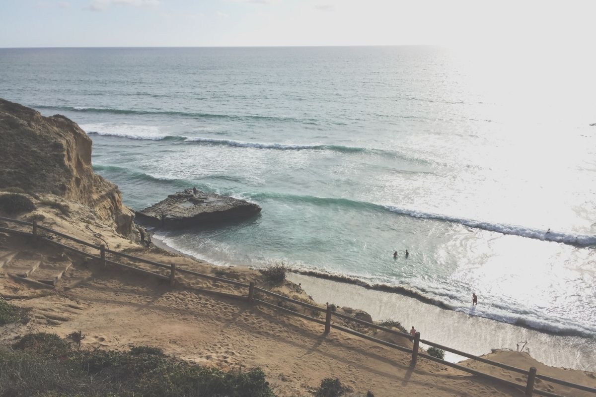
Southern California Beaches via Highway 1
Start here: Malibu, CA
End here: Coronado, CA
Total miles: 157 miles
How many days: 3 days
Get the route here.
Los Angeles is filled with scenic road trips, but nothing compares to a tour of Southern California beaches. Start this sun-soaked road trip on the coastline of Malibu. Travel south to hit the Santa Monica Pier for some carnival games and appetizers at the Lobster. Treat yourself to a night on the beach at Shutters and wake up and take a moment to people-watch before heading down the Pacific Coast Highway (PCH) towards Orange County to visit the home of the U.S. Open of Surfing in Huntington Beach. Although this route is slower than the jam-packed 5 or 405, take in the views and scenic stops along the way.
Grab a cocktail overlooking the Pacific Ocean at the Deck in Laguna Beach before heading further south on this unforgettable California road trip. Laguna Beach is also home to some beautiful hiking and parks, so plan time to visit longer if you want to explore these coastal rolling hills longer.
Round out your trip in San Diego County by hiking a famous California State Park, the Torrey Pines Nature Preserve. Continue your route down this scenic road to the world-famous shores of Coronado with a stop at the Hotel del Coronado. Grab a cocktail on the sun deck to reminisce on your favorite part of Southern California's scenic drives.
Scenic Drives In The PNW
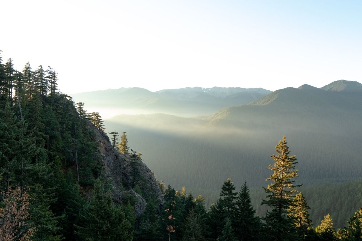
Olympic Peninsula Loop
Start here: Olympia, WA
End here: Olympia, WA
Total miles: 471 miles
How many days: 4 days
Get the route here.
This scenic drive is a stunner and not to be missed. Just east of Seattle, this loop outlines Olympic National Park and shows off the lush beauty of Washington State. Although you may not be enjoying the sunshine, the wildlife, forests, and surrounding greenery you will travel through will leave you wanting more, even if you need your umbrella and rain boots. This loop is filled with plenty of stops, so take some time to enjoy your drive as you cover the distance.
I recommend starting in Olympia, Washington State's capital on the southern end of Puget Sound. After grabbing some coffee and a local pastry at Olympia Coffee Roasting Company, drive towards the Quinalt Valley. Take some time to explore the history of this area but enjoying the rainforest trail, old lodge, and the world's largest spruce tree. From here, do not miss the beach and quaint cabins of Kalaloch Lodge in Olympic National Park. Make sure to book these in advance as they are popular with visitors. Spend the evening bird watching before enjoying dinner in the Lodge's restaurant.
In the morning, grab breakfast to-go from the Lodge and take it 10 minutes North to explore the beauty and tidepools of Ruby Beach. From here, do not miss a hike through the Hoh Rainforest. Spend time hiking and exploring the various trails in this ancient, mossy forest. Continue North to see the massive rock formations of Rialto Beach and end your day in Port Angeles, just south of the Canadian border. In the morning, explore the windy byway along the shore of Lake Crescent, enjoy lunch at the lodge and rent a kayak for an afternoon tour of the lake. Treat yourself to a stay at the Sol Duc Hot Springs Resort after hiking out to the waterfall.
On the final day of this scenic drive, don't miss Hurricane Ridge, an extreme wind and high-altitude detour which will also bring you some of the best scenic views of your trip. From here, drive back to Olympia to finish your loop. Or, if adventure is still calling, take your car across the Puget Sound on the ferry to Seattle and continue your exploring!
Mount Rainier Loop
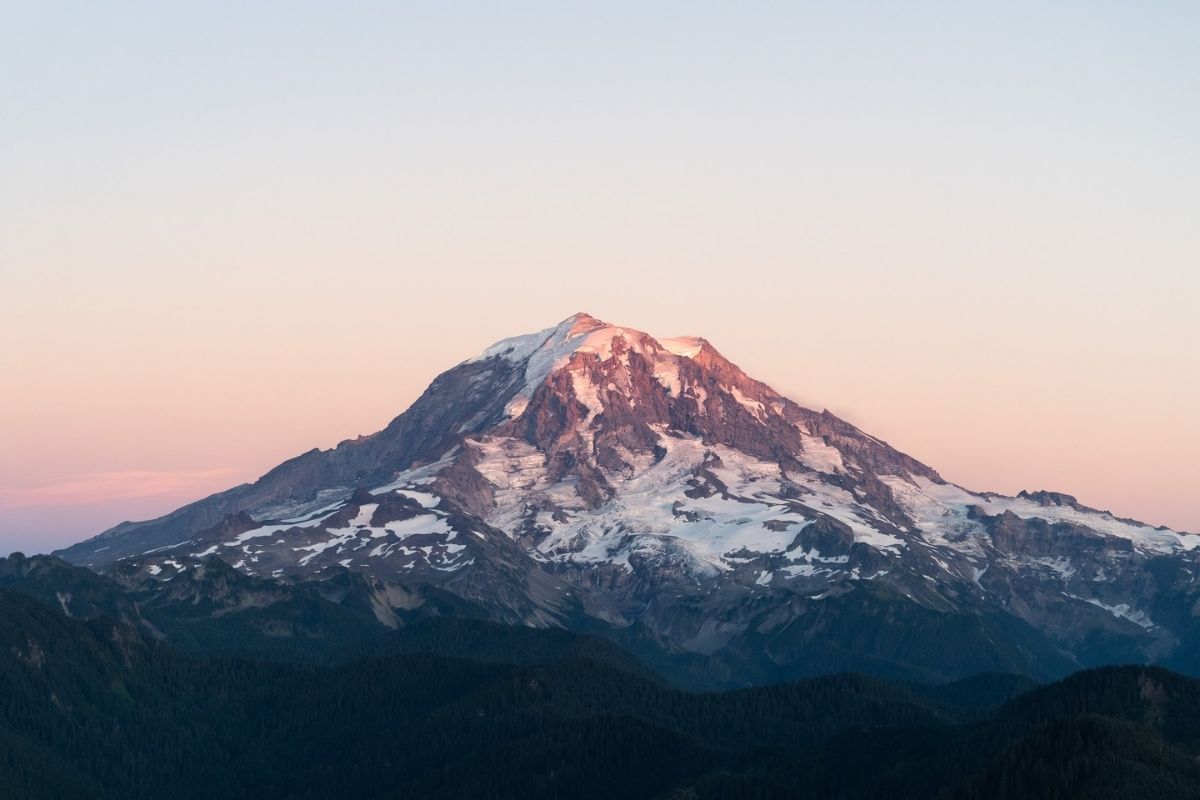
Start here: Tacoma, WA
End here: Tacoma, WA
Total miles: 204 miles
How many days: 3
Get the route here.
When visiting the Pacific Northwest, the towering 14, 410 foot Mount Rainier is rarely out of view. No matter the season, the beauty surrounding Mount Rainier is worth the visit. Between incredible views, hikes, waterfalls, wildflowers, and snow sports, Mount Rainer National Park delivers year-round. This scenic drive starts in the city of Tacoma, WA, and is one of the best scenic drives around Mount Rainier. This also makes for a great weekend trip.
From Tacoma, stop in the foothill town of Enumclaw to fill your gas tank and pick up some snacks for this scenic drive into the Mount Rainier area. Enjoy the countryside until you begin to enter Federation Forest State Park and take a moment to stretch your legs in the dense forests on one of the shorter hiking trails. Refuel amongst the trees in one of the picnic areas and stop at Suntop Lookout, for incredible 360° views of Mt. Rainier.
After taking in the stunning views, don't miss Skookum Falls on the way to Crystal Mountain Ski Area. This stop makes for a great day trip no matter the season. During summer, chairlift to the summit for a sunset dinner or ride your mountain bike down the slope. Stay the night or take the short drive to Sunrise Visitor Center to continue on your scenic loop.
The Sunrise Visitor Center is a must for park information and for a stop at 6,400 feet elevation, the highest location you can drive into the park. Continue on and stretch your legs on the 1.5-mile loop through the Grove of the Patriarchs, an ancient dense forests environment filled with trees over 1,000 years old. Do not miss the Martha Falls Viewpoint on your way on the byway to Paradise.
Visitors flock to Paradise year-round for the incredible views. Sitting at 5,400 feet, The Paradise Inn and Dining Room will add a rustic charm to your scenic drive. Take time to stroll the grounds and do not miss the incredible photo opportunities from this scenic "paradise."
In the morning, do not miss the pullouts for Glacier Vista Exhibit, Narada Falls, or Christine Falls. Longmire makes for a great stop to refuel in a cozy, rustic lodge. Take the short stroll along the popular nature trail, The Trail of the Shadows, before heading back towards Tacoma to wrap up one of the best scenic drives in the PNW.
The Oregon Coast on Highway 101
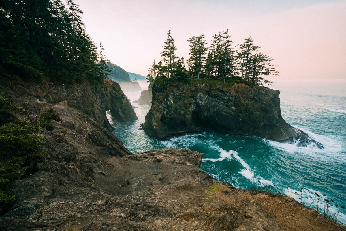
Start here: Brookings, OR
End here: Astoria, OR
Total miles: 338 miles
How many days: 5 days
Get the route here.
This winding route up the Oregon coast is filled with scenic views. Although one of the best scenic drives in the Pacific Northwest, this journey is not for those in a rush, as the highway is very narrow and has only two lanes. However, the coastal views and scenery pass the time between stops. The highway is spotted with quaint towns that are home to incredible, fresh seafood dishes. The foggy marine layer and coastal hikes make this scenic byway a cozy tour of Oregon's coast and countryside.
From Brookings, just north of the California border, drive north towards Gold Beach and up the coast to Coos Bay, Oregon's largest coastal city. Golfers will love a stop at the famed Bandon Dunes Golf Course and hikers will love the 1.2 mile Redwood Nature Trail along the way. In Coos Bay, explore the shipbuilding history of the area and grab some local oysters from Shark Bites Seafood Cafe and a craft brew and sandwich from 7 Devil's Brewing. Spend the night glamping with amazing views at Bay Point Landing.
In the morning, continue your route towards Florence. Check out the Oregon Dunes National Recreation Area for views of the massive coastal dunes that draw visitors from all over for dune buggy and sandboarding recreation. As you arrive in Yachats, check out Thor's Well or hike the beautiful 804 trail for 1.7-miles of birdwatching and tide-pooling. Spend the evening enjoying the artsy culture of Yachats browsing galleries and the famed rocks at Planet Yachats. Enjoy a fresh seafood dinner at Luna Sea Fish House and spend your night with an ocean view at the Overleaf Lodge.
In the morning, grab coffee at Green Salmon and continue north to the tidepools in Yaquina Head Outstanding Natural Area. Stroll out to the Yaquina lighthouse and look for sea lions. Grab lunch at Mo's Seafood or Local Oceans Seafood or spend some time checking out Newport's craft breweries. Stay the night in Newport at the Ocean House for coastal views or continue north towards Astoria.
Stop along the beach in Lincoln City to look for blown glass "floats" in the water. Local artisans hide over 3,000 pieces along the beach for visitors to find! As you continue north, don't miss the Tillamook Cheese Visitors Center for incredible cheese and ice cream tastings. Spend the night in a cabin or yurt at the Cape Lookout State Park.
In the morning, try your hand at crabbing at Kelly's Brighton Marina before heading to the charming town of Manzanita. Enjoy the farmer's market, local winery, and picnic options from Manzanita Grocery and Deli. Spend your evening on the beach before spending the night with a fireplace at the Cannon Beach Hotel. Wrap this scenic drive in the family-friendly town of Astoria, just 2 hours west of Portland.
Scenic Drives Near Colorado
Trail Ridge Road

Start here: Estes Park, CO
End here: Grand Lake, CO
Total miles: 48 miles
How many days: 1 day
Get the route here.
This 48-mile highway connects the east and west side of Rocky Mountain National Park and is knows as the "highway to the sky." At a peak of 12, 183 feet, this road is the highest paved road in the U.S. National Park system. This makes for a great weekend adventure. Trail Ridge Road is only open during the summer and early fall due to changing weather conditions. Always check current road conditions before heading out.
Grab a picnic from Scratch Deli & Bakery in Estes Park before heading out for your adventure. Fill up with gas and get ready to experience one of the most beautiful scenic drives in the country. This beautiful route climbs over 4,000 feet in altitude and takes from a forest to alpine tundra within minutes. Multiple pullovers are marked to take in the views from several vistas along the highway. Bring layers for the change in elevation and keep watch for bighorn sheep, elk, and wildflowers during the spring seasons. Stop at the Alpine Visitor Center for more information on the area and to grab a snack if necessary. Stay the night in Grand Lake, CO or go back the way you came and take it all in from a different angle!
Dinosaur Diamond Scenic Byway
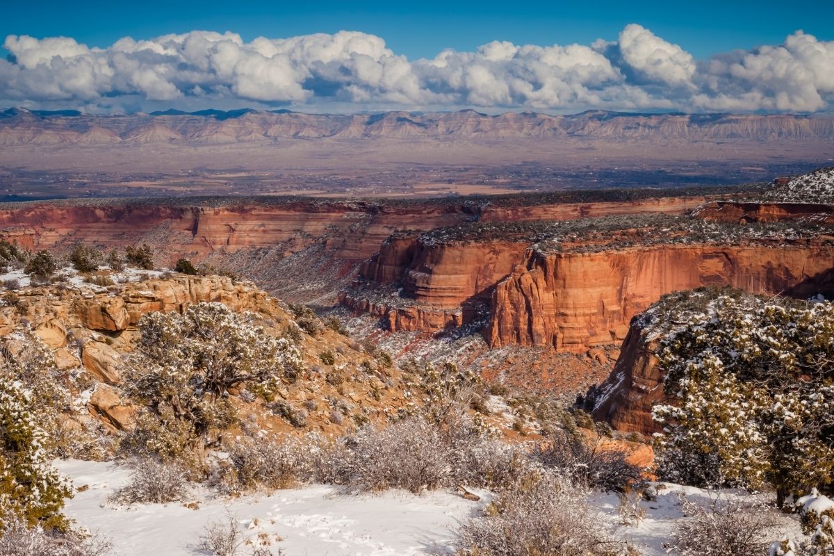
Start here: Grand Junction, CO
End here: Vernal, UT
Total miles: 145 miles to Vernal, UT or 512 miles for a full loop
How many days: 2-6 days
Get the route here.
Take a tour of this historic area in northwest Colorado filled with dinosaur fossils and Native American history. This diamond-shaped scenic drive begins in the red rock formations and canyons above Grand Junction and takes you north to Dinosaur National Monument on the Colorado/Utah border before heading into eastern Utah and eventually back to Colorado.
Start your journey in Grand Junction, CO, and enjoy the views of the Colorado River that runs through town. Take a short detour from the byway to explore the Colorado National Monument's 23-mile Rim Rock Drive for incredible views of the colorful canyon and monoliths.
Mountain bikers will love a stop in Fruita, which is home to the Bookcliff, a favorite visit due to the rolling hills and options for riders of all levels. Fruita is also home to the Dinosaur Journey Museum if you want more information on certain fossils in the area.
Continue north towards the Utah border and cross over to Vernal, UT, a perfect place to stay for your visit to Dinosaur National Monument. Hike around the monument to take in the ancient fossils and interpretive panels. Adventurers will love a rafting trip down the Green River. From here, you can continue on the scenic byway through deep canyons carved by the Colorado River to Arches and Canyonlands National Parks before heading back to CO.
Million Dollar Highway
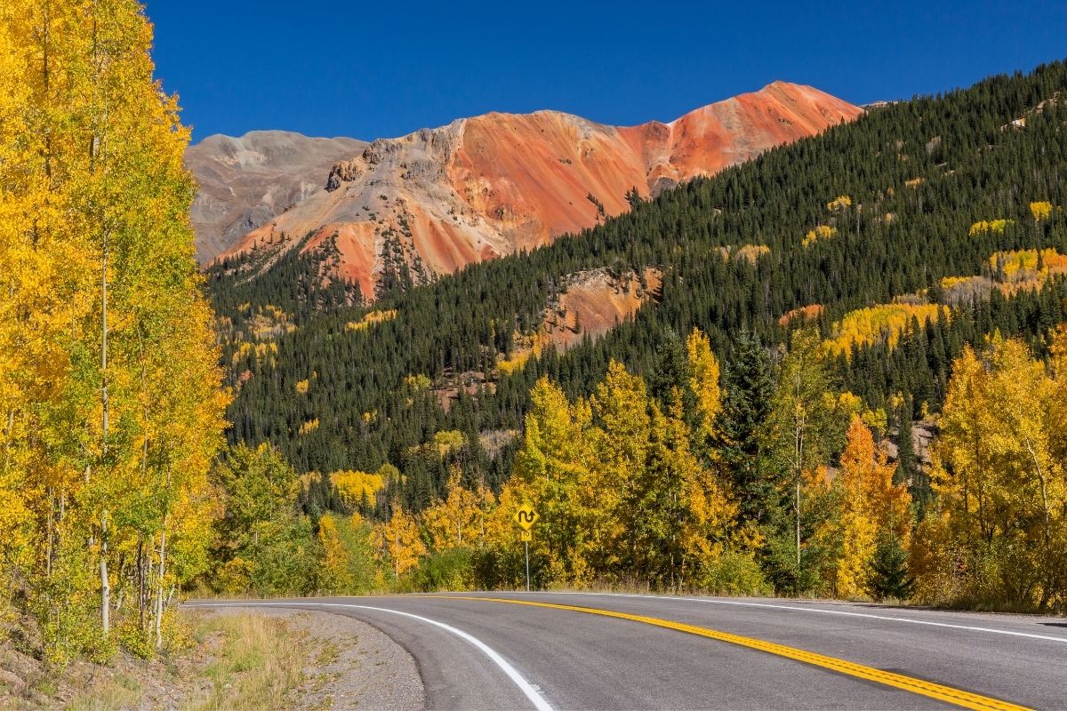
Start here: Durango, CO
End here: Telluride, CO
Total miles: 120 miles
How many days: 2 days
Get the route here.
Known for the supposed cost to build the road, the "Million Dollar Highway" climbs the San Juan Mountains to the 11,018 foot Red Mountain Pass. Known for the incredible views and switchbacks, this scenic drive is sure to deliver stunning scenery throughout the seasons. Hop in the car and turn this into an epic weekend trip full of mining history.
Start your drive in Durango, one of the historic towns from the mining surge in the 1880s. Drive through the San Juan National Forest to Silverton, CO. Keep watch for historic sites from the mining era along the route. This is the official start of the "Million Dollar Highway" to Ouray, CO. There are no guardrails and the road can feel dangerous with all of the switchbacks. Take your time to enjoy the climb to Red Mountain Pass. Stop to take in the views before heading down into Ouray through the Uncompahgre Gorge.
Once in Ouray, stop for pictures at the overlook before enjoying all that this town on the valley floor has to offer. The historic town is fun to explore with historic mining shops, restaurants, and hot springs. Make a point to visit Box Canyon Falls before heading on to Telluride in the morning.


 TOP
TOP